
ORTOFOTO
Una ortofoto o ortofotografia è una fotografia aerea che è stata geometricamente corretta (cioè che ha subito procedimento di ortorettifica) e georeferenziata in modo tale che la scala di rappresentazione della fotografia sia uniforme, cioè la foto può essere considerata equivalente ad una carta geografica.
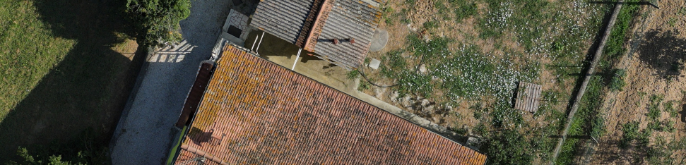
A differenza di una semplice foto aerea, un’ortofoto può essere usata per misurare distanze reali, poiché raffigura una accurata rappresentazione della superficie della Terra; infatti è stata aggiustata in base ai rilievi topografici, alla distorsione della lente e all’orientamento della macchina fotografica (roll, pitch, heading).
La stessa tecnica di rappresentazione è sempre più diffusa anche nella “fotogrammetria del vicino” (close-range photogrammetry). L’ortofotoproiezione è spesso utilizzata per rappresentare in prospetti bidimensionali elementi architettonici molto complessi come volte, cupole, chiese barocche ecc. (Fonte:Wikipedia)
Qui sono riportati i prodotti digitali rilevati mediante l’impiego di aeromobili a pilotagigo remoto, in seno al Programma FESR Toscana 2021-2027, ottenuti tramite l’impiego della piattaforma messa a disposizione da Regione Toscana nell’ambito dell’accordo 3D-Data. In questa sezione sono proposti i seguenti prodotti digitali, liberamente consultabili ed estraibili in licenza CCBY 4.0:
| N. |
Località | SR |
GSD |
Mb |
Tipologia | Download + metadato (Open.data) |
| 1 | Via Orlandini | EPSG:3857 – WGS 84 | 65 | JPG | Risorsa +Metadato | |
| 2 | Le Colmate, abitato | EPSG: 3003 | 3,01 cm/px | 135 | JPG | Risorsa + Metadato |
| 3 | Le Colmate, torrenti | EPSG: 3003 | 3.48 cm/px | 48 | JPG | Risorsa + Metadato |
| 4 | Via della Resistenza | EPSG: 3003 | 2.59 cm/px | 14 | JPG | Risorsa + Metadato |
| 5 | Piazza Sandro Pertini | EPSG: 3003 | 1.66 cm/px | 7 | JPG | Risorsa + Metadato |
| 6 | Cava Grande | EPSG: 3003 | 3.18 cm/px | 32 | JPG | Risorsa + Metadato |
| 7 | Monsummano Alto | ESPG: 3003 | 2.18 cm/px | 416 | TIFF | Risorsa + Metadato |
| 8 | Monsummano Alto | ESPG: 3003 | 3.15 cm/px | 34 | JPG | Risorsa + Metadato |
| 9 | Via F. Carrara | EPSG: 3003 | 1.97 cm/px | 35 | JPG | Risorsa + Metadato |
| 10 | Via dei Girasoli | EPSG: 32632 | 1.79 cm/px | 750 | JPG | Risorsa + Metadato |
| 11 | Via Pozzarello | EPSG: 3003 | 1.99 cm/px | 86 | JPG | Risorsa + Metadato |
| 12 | Via Francesca La Pineta | EPSG: 3003 | 2,16 cm/px | 115 | JPG | Risorsa + Metadato |
| 13 | Via del Porto dei Masoni | EPSG: 3003 | 2.7 cm/px | 134 | JPG | Risorsa + Metadato |
| 14 |
Via Melazzano | EPSG:3003 | 2.55 cm/px | 152 | TIFF (RAW) | Risorsa + Metadato |
| 15 | Via Vaticano |
EPSG:3003 | 2.48 cm/px | 122 | TIFF (RAW) | Risorsa + Metadato |
| 16 | Via Melazzano | EPSG:3003 | 2.39 cm/px | 137 | TIFF | Risorsa + Metadato |
| 17 | Via Campitelli | EPSG:3003 | 4.18 cm/px | TIF (RGB) | Risorsa + Metadato | |
| 18 | Via Campitelli | EPSG:3003 | 2.87 cm/px | TIF (MS) | Risorsa + Metadato | |
| 19 | Colle di Monsummano Alto | EPSG:3003 | 4,64 cm/px | TIF (RGB) | Risorsa + Metadato | |
| 20 | Colle Monsummano Alto | EPSG:3003 | 3.08 cm/px | TIF (NIR) | Risorsa + Metadato | |
| 21 | Via delle Rave | EPSG:3003 | 2.19 cm/px | TIFF | Risorsa + Metadato | |
| 22 | Piazza Carlo Alberto Dalla Chiesa | EPSG:3003 | 2.10 cm/px | TIFF | Risorsa + Metadato | |
| 23 | Via Occhibelli | EPSG:3003 | 2.54 cm/px | TIFF | Risorsa + Metadato | |
| 24 |